Oklahoma just became the first state to release draft district maps for the next decade. These maps are notable in that they use American Community Survey data — not Census data — to equalize population. The maps were also released in the least user-friendly way possible, without shapefiles or block assignment files that would facilitate their analysis.
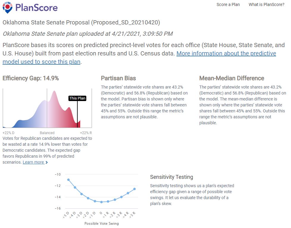
Nevertheless, PlanScore executive director (and data whiz) Mike Migurski managed to evaluate the maps’ likely partisan effects. And they’re atrocious. The state house map has an expected pro-Republican efficiency gap of 13%, remaining in double digits in almost any electoral environment. The state senate map has an expected pro-Republican efficiency gap of 15%, also remaining in double digits in essentially all electoral conditions. These are staggeringly bad scores, at the outer edge of the historical distribution. They’re a preview of the ruthless gerrymandering we’re likely to see this cycle in states with single-party control of redistricting. And they probably explain why Oklahoma released the maps in such a nontransparent format — to try to prevent their partisan implications from being apparent.